Historic Strasbourg 1800 Live Map
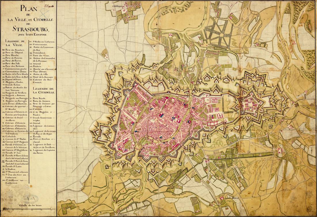
The Historic Strasbourg Live Map is an interactive web map with a toolbar to help you explore the geography and features of the city of Strasbourg as they were back in 1800. The web map is based upon the historic city plan map, “Plan de la Ville et Citadelle de Strasbourg avec leurs Environ” which is seen above.
Exploring history and geography with a web map
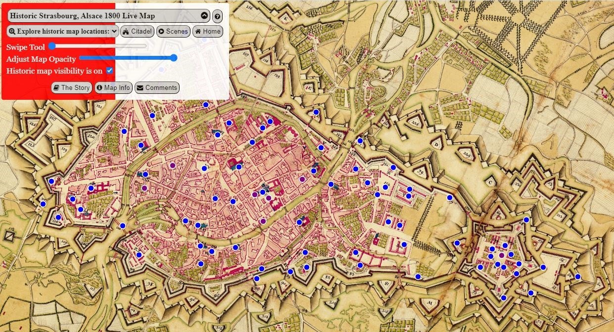
When you navigate to the Historic Strasbourg Live Map page, you’ll see a welcome screen containing a set of instructions. After reviewing and closing the form, you’ll see the historic map with a set of blue point features which have been identified and captured from the original 1800 map. Click on any point and see information on that historic map feature which was identified in the plan map legend, and now includes the English translation in the web map.
Next, click on the “Explore historic map locations” button to select from several locations to help you explore the map. You can quickly get a feel for the location of the great Cathedral, the famous cannon foundry, the many churches, infantry and cavalry barracks and gunpowder magazines.
Then click on the “Citadel” command on the map toolbar to zoom to the actual Citadel bastions and walls still visible today in Strasbourg’s Citadelle Park. Then use the swipe and opacity tools to help you compare the historic map with the current landscape. It all helps one to get a feeling for the geography and terrain of that bygone era.
The Historic Strasbourg 1800 Live Map was built using the OpenLayers map library, and uses a historic plan map image and OpenStreetMap as its basemap foundation. Click the link above or the image below to open the map.
Finally, a number of scene locations from the historical novel, Guardians of The Crossroads, have been included. You can use the “Scenes” button on the map toolbar to click your way through some of the locations from the story.
Special thanks to the following organizations for making the map possible:
- Thanks to OpenStreetMap and its contributors for sharing their work and open basemap.
- Thanks to OpenLayers and its contributors for their open source map library on which this map was built.